 geo.be Metadata Catalog
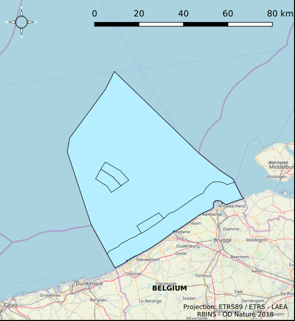
Marine Spatial Plan
Type of resources
Available actions
Topics
INSPIRE themes
Keywords
Contact for the resource
Provided by
Years
Formats
Representation types
Service types
-

INSPIRE compliant download service (ATOM) for geographic information of the Marine Spatial Plan made available by the Royal Belgian Institute for Natural Sciences (RBINS).
-

The Royal Decree of 22 May 2019 establishing a marine spatial plan defines 1 coastal protection experiments zone: Zone for coastal protection experiments (Art. 16§2). It replaces the 2014 Marine Spatial Plan, which is included for completeness. The Royal Decree of 20 March 2014 establishing a marine spatial plan defines in its Art. 12. §1 one zone for coastal protection experiments. This zone is made available digitally in the resource described by this metadata document. Please refer to the Belgian official gazette (\"Moniteur belge/Belgisch Staatsblad\") for official reference information.
-
The Royal Decree of 22 May 2019 establishing a marine spatial plan defines 7 fishery management zones: Professional fisheries (Art. 13), Passive fisheries area (Noordhinder Noord) (Art. 14§4), Passive fisheries area (Noordhinder Zuid) (Art. 14§4), Passive fisheries (Fairybank) (Art. 14§4), Search area 1 for fisheries techniques (Art. 6§1), Search area 2 for fisheries techniques (Art. 6§1), Search area 3 for fisheries techniques (Art. 6§1). It replaces the 2014 Marine Spatial Plan, which is included for completeness. The Royal Decree of 20 March 2014 establishing a marine spatial plan defines in its Art. 6, six fisheries management areas: Regular regime, Art. 6 § 1; Fisheries management area 1, Art. 6 § 1.1°; Fisheries management area 2, Art. 6 § 1.2°; Fisheries management area 3, Art. 6 § 1.3°; Fisheries management area 4, Art. 6 § 1.4°; Fisheries management area 5, Art. 6 § 3. These zones are made available digitally in the resource described by this metadata document. Please refer to the Belgian official gazette (\"Moniteur belge/Belgisch Staatsblad\") for official reference information.
-

INSPIRE compliant view service for geographic information of the Marine Spatial Plan made available by the Royal Belgian Institute for Natural Sciences (RBINS).
-
INSPIRE compliant download service (WFS) for geographic information of the Marine Spatial Plan made available by the Royal Belgian Institute for Natural Sciences (RBINS).
-

The Royal Decree of 22 May 2019 establishing a marine spatial plan defines 11 military use and storage sites for war munition zones: Exercise area for sweeping mines (Buiten Ratel) (Art. 17§1), Exercise area for sweeping mines - NB-01 (Westhinder) (Art. 17§1), Exercise area for sweeping mines - NBH-10 (Wenduine) (Art. 17§1), Exercise area for sweeping mines - QZR 040 (Art. 17§1), Munition destruction area (Art. 17§2), Area for shooting exercises on floating objects (Art. 17§3), Area for exercises in shallow waters (Art. 17§4), Area for shooting exercises from land - big sector (Art. 17§5), Area for shooting exercises from land - medium sector (Art. 17§5), Area for shooting exercises from land - small sector (Art. 17§5), Storage site for war munition Paardenmarkt (Art. 18§1). It replaces the 2014 Marine Spatial Plan, which is included for completeness. The Royal Decree of 20 March 2014 establishing a marine spatial plan defines in its Art. 13. and Art. 14., resp. nine zones for military use and one storage site for war munition: three zones for shooting exercises from land direction sea (Art 13. § 1 small sector, Art 13. § 1 medium sector, Art 13. § 1 large sector), four exercise areas for sweeping mines (Art 13. § 3, Exercise area 1 for sweeping mines, Art 13. § 5, Exercise area 2 for sweeping mines, Art 13. § 9, Exercise area 3 for sweeping mines, Art 13. § 13, Exercise area 4 for sweeping mines), one area for shooting exercises on floating objects (Art 13. § 7), one area for defusing mines (Art 13. § 11) and one zone to safeguard the closed storage site for war munition \"Paardenmarkt\" (Art. 14. § 1). These zones are made available digitally in the resource described by this metadata document. Please refer to the Belgian official gazette (\"Moniteur belge/Belgisch Staatsblad\") for official reference information.
-
The Royal Decree of 22 May 2019 establishing a marine spatial plan defines 1 radar tower: Radar Oostdyck (Art. 21§3). Please refer to the Belgian official gazette (\"Moniteur belge/Belgisch Staatsblad\") for official reference information.
-
The Royal Decree of 22 May 2019 establishing a marine spatial plan defines 5 commercial and industrial zones: Zone A for commercial and industrial activities (Art. 23§1), Zone B for commercial and industrial activities (Art. 23§1), Zone C for commercial and industrial activities (Art. 23§1), Zone D for commercial and industrial activities (Art. 23§1), Zone E for commercial and industrial activities (Art. 23§1). Please refer to the Belgian official gazette (\"Moniteur belge/Belgisch Staatsblad\") for official reference information.
-

The Royal Decree of 22 May 2019 establishing a marine spatial plan defines 6 energy, cable and pipeline zones: Area 1 for renewable energy (Eastern zone) (Art. 8§1), Area 2 for renewable energy (Noordhinder North) (Art. 8§2), Area 3 for renewable energy (Noordhinder Zuid) (Art. 8§3), Area for renewable energy - zone 4 (Fairybank) (Art. 8§3), Modular offshore grid for transmission of energy (Art. 8§5), Pipelines and cables corridor (Art. 9§1). It replaces the 2014 Marine Spatial Plan, which is included for completeness. The Royal Decree of 20 March 2014 establishing a marine spatial plan defines in its Art. 9. five dredged material disposal sites (Dredged material disposal site S1, Art. 9 § 6.1°; Dredged material disposal site S2, Art. 9 § 6.2°; Dredged material disposal site Bruggen en Wegen Oostende, Art. 9 § 6.3°; Dredged material disposal site Bruggen en Wegen Zeebrugge Oost, Art. 9 § 6.4°; Dredged material disposal site Bruggen en Wegen Nieuwpoort, Art. 9 § 6.5°). These zones are made available digitally in the resource described by this metadata document. Please refer to the Belgian official gazette (\"Moniteur belge/Belgisch Staatsblad\") for official reference information.
-

The Royal Decree of 22 May 2019 establishing a marine spatial plan defines 5 nature conservation areas: Special area for conservation 'The Flemish Banks' (Art. 7§1), Special area for conservation 'Vlakte van de Raan' (Art. 7§3), Special protection area for birds - SPA 1 (Art. 7§5.1°), Special protection area for birds - SPA 2 (Art. 7§5.2°), Special protection area for birds - SPA 3 (Art. 7§5.3°). It replaces the 2014 Marine Spatial Plan, which is included for completeness. The Royal Decree of 20 March 2014 establishing a marine spatial plan defines in its Art. 7., six nature conservation sites: two special areas for conservation (Art. 7. §1, Special area for conservation 'Vlaamse Banken' and Art. 7. §3, Special area for conservation 'Trapegeer stroombank'), three special protection zones for birds (Art7§4.1°, SBZ1, Art7§4.2°, SBZ2, Art7§4.3°, SBZ3), and one marine reserve (Art7§8, Marine reserve 'Baai van Heist'). These zones are made available digitally in the resource described by this metadata document. Please refer to the Belgian official gazette (\"Moniteur belge/Belgisch Staatsblad\") for official reference information.